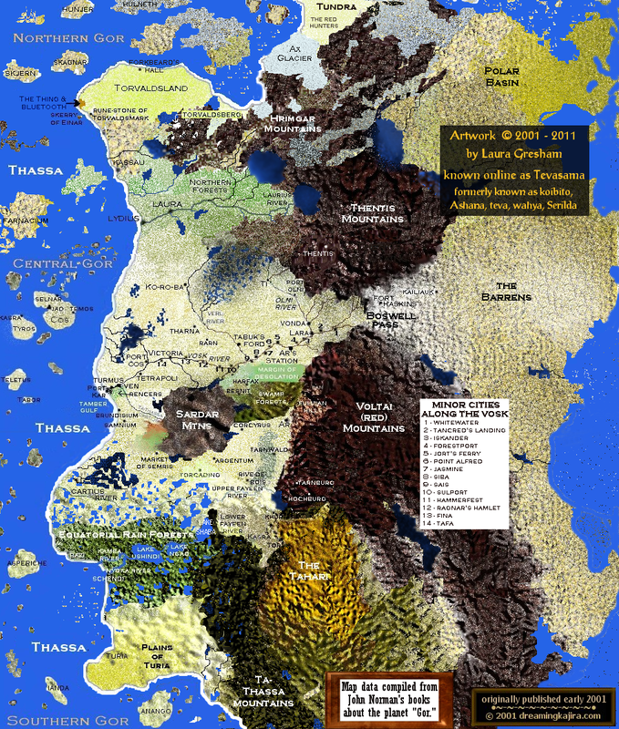
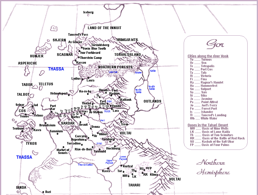
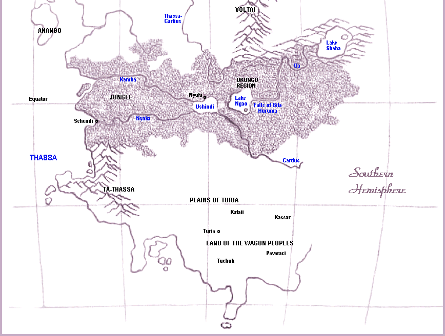
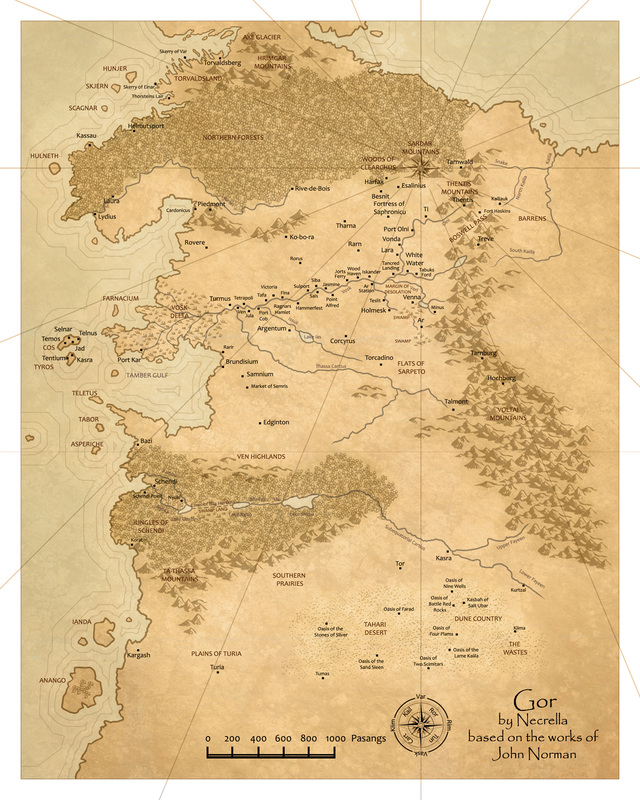
Maps Of Gor
"I regarded the vast map on the floor of the chamber. I could see, high on the map, Ax Glacier, Torvaldsland, and Hunjer and Skjern, and Helmutsport, and lower, Kassau and the great green forests, and the river Laurius, and Laura and Lydius, and lower, the islands, prominent among them Cos and Tyros; I saw the delta of Vosk, and Port Kar, and, inland, Ko-ro-ba, the Towers of the Morning, and Thentis, in the mountains of Thentis, famed for her tarn flocks; and, to the south, among many other cities, Tharna, of the vast silver mines; I saw the Voltai Range, and Glorious Ar, and the Cartius, and, far to the south, Turia, and near the shore of Thassa, the islands of Anango and Ianda, and on the coast, the free ports of Schendi and Bazi. There were, on the map, hundreds of cities, and promontories and peninsulas, and rivers and inland lakes and seas... The beast had been taken southeast of Ar, while moving southeast. Such a Path would take it below the eastern foothills of the Voltai and to the south. It was incredible." (Tribesmen of Gor, chapter 1)